Protecting the Water’s Edge: A Guide to
Shoreline Regulations
In Minnesota, altering a shoreline is not as simple as moving a few rocks or clearing brush. Because the state’s 10,000+ lakes and rivers are public resources, any project—from installing riprap to building a beach—is strictly regulated to protect water quality, fish habitat, and erosion control.
There are also grants within certain districts and lakes that will help pay for your rip rap or other shoreline conservation alterations. I hioghly suggest you look into them at the Watershed District, Lake Assocation,, and the DNR before starting. For instance on Blad Eagle Lake in White Bear Lake, the Rice Creek Watershed has a grant that when applied for and received, you could get 70 to 80% of the total cost paid for by the grant. When a project can be anywhere from $12,000 to $20,000 and beyond, that’s a huge helping hand.
Before you start, it is critical to understand the Ordinary High Water Level (OHWL). The OHWL is a set elevation that serves as the boundary between your private property and the State of Minnesota's public land. You can find your lake's specific OHWL using the Minnesota DNR Lake Finder.
1. Riprap Regulations: When Rocks Are (and Aren’t) Allowed
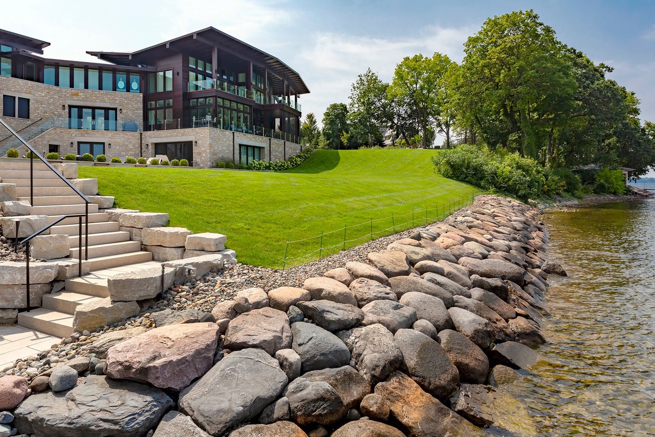
Riprap refers to natural rocks placed along a shore to stop erosion. The Minnesota Department of Natural Resources (DNR) only allows riprap when there is a demonstrated need to stop active erosion; it cannot be used purely for landscaping or aesthetics.
- No Permit Required Conditions: You typically don't need a DNR permit if:
- The project covers less than 200 linear feet.
- Only natural rock (6 to 30 inches in diameter) is used—concrete and debris are prohibited.
- Rocks extend no more than 6 feet waterward of the OHWL.
- The finished slope is no steeper than 3:1 (3 feet horizontal for every 1 foot vertical).
- The rock does not cover emergent vegetation like cattails or bulrushes.
- Permit Required: An individual Public Waters Work Permit is mandatory if you fail to meet any of the above criteria or if you are in a sensitive area, such as a designated trout stream or fish spawning zone.
2. Local Watershed Districts: Stricter Rules for Your Shore
While the DNR sets statewide minimums, Watershed Districts often have significantly higher standards.
- Higher Standards: Districts like the
Minnehaha Creek Watershed District
may require an Erosion Intensity Evaluation. They often prioritize "bioengineering" (using native plants and coir logs) over hard rock riprap.
- Mandatory Buffers: Many local authorities require a vegetative buffer (typically 10 feet of native plants) to be installed alongside any new riprap to filter runoff.
- Permit Thresholds: Moving as little as 10 cubic yards of material (including rock, soil, or sand) within a "Shore Impact Zone" often triggers the need for a local permit.
3. Other Shoreland Alterations & Restrictions
- Sand Blankets (Beaches): To add sand, it must be clean and inorganic, no more than 6 inches deep, and no wider than 50 feet or half the lot width. You can typically only add new sand once in the property's lifetime.
- Vegetation Removal: Intensive clearing of trees and shrubs is usually restricted. Most ordinances only allow limited clearing (10-20%) for a view or path to the water.
· Retaining Walls: New retaining walls at or below the OHWL are prohibited in most cases because they damage the near-shore environment and scour the lakebed.
- Structures: Buildings, decks, and patios are subject to setback rules based on your lake's classification. Total "impervious surface" (hard coverage) on your lot is usually capped at 25%.
4. Who to Contact Before Breaking Ground
To avoid fines or being forced to remove unauthorized work, you must consult the following agencies in order:
- DNR Area Hydrologist: To verify OHWL and erosion needs.
- Local Watershed District: To check for stricter local stabilization and grant opportunities.
- City or County Planning/Zoning: For permits regarding land movement above the OHWL.
I hope this was helpful and if you should ever have any questions please don’t hesitate to call me. Tony @ 651-208-1701 or tony @lakeplace.com
With 40 years of mastery and over $5 billion in managed closed sales, Tony Sampair doesn't just navigate the market—he defines it. A veteran executive leader with a legacy of #1 national rankings, Tony has spent four decades scaling brokerages and architecting elite agent productivity for lakeshore properties across Minnesota, Wisconsin, and Michigan.
Tony and The Luxury Lake Team at Lakeplace.com are the #1 locally, and regionally dominant experts for the most coveted waterfront markets. From the historic shores of White Bear Lake to Bald Eagle Lake the premier properties of Forest Lake and the Chisago Lakes area, they provide a level of strategic support that is simply unmatched in the North East metro market.
By pairing deep-rooted local expertise with the powerhouse marketing engine of LakePlace.com & Dane Arthur Real Estate Agency, they bridge the gap between buyers and sellers with precision. When you work with Tony, you aren’t just hiring an agent; you are leveraging a lifetime of market dominance in the heart of lake country.
Tony Sampair-651-208-1701